Year: FALL 2020
Typology: Mixed-use Social Housing
About: Graduate studies/ University of Virginia
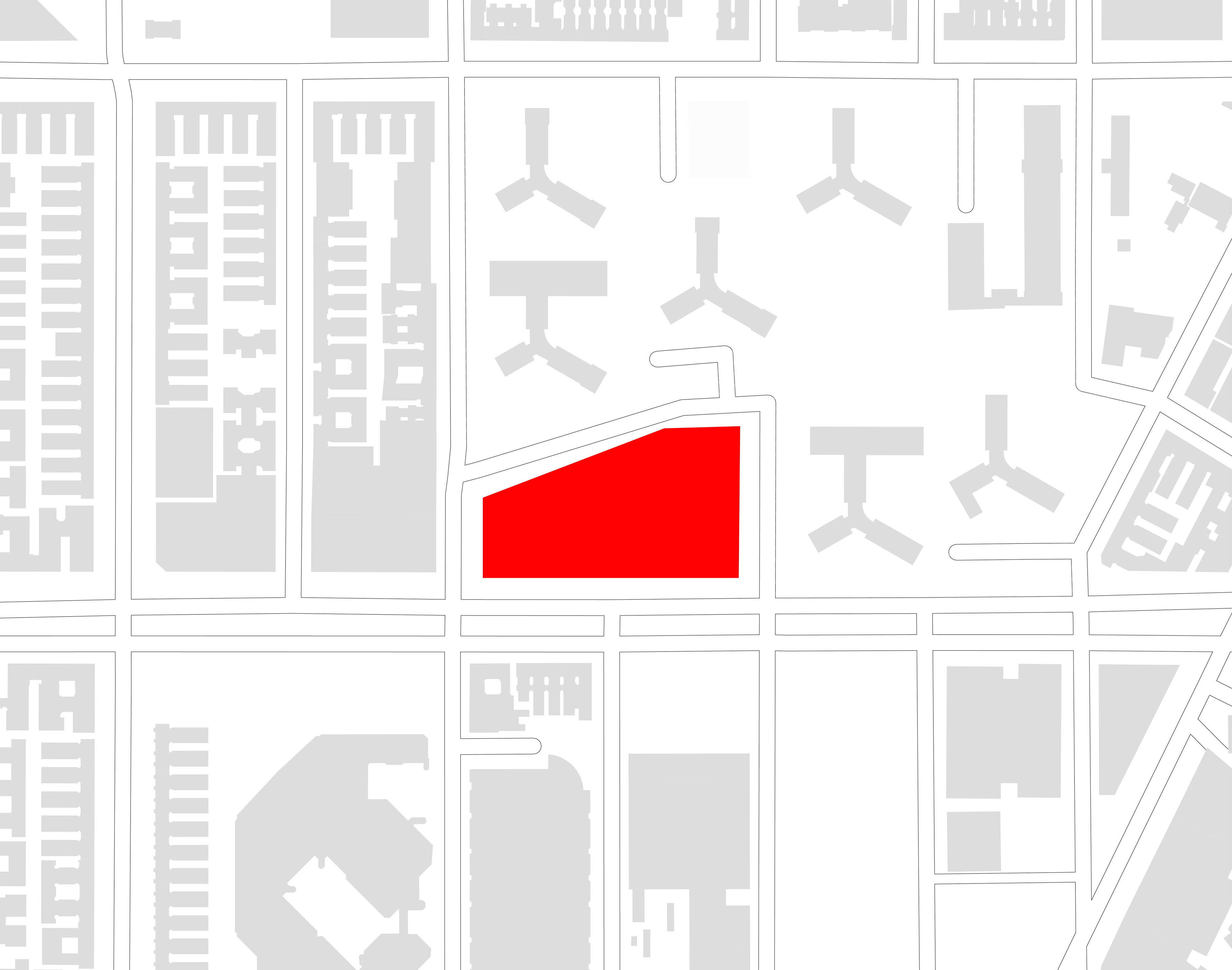
Project Location: Manhattanville, NY
Advisor: Mona El Khafif
-Collaborative work with Xinyuan Li [M.Arch 2021]-

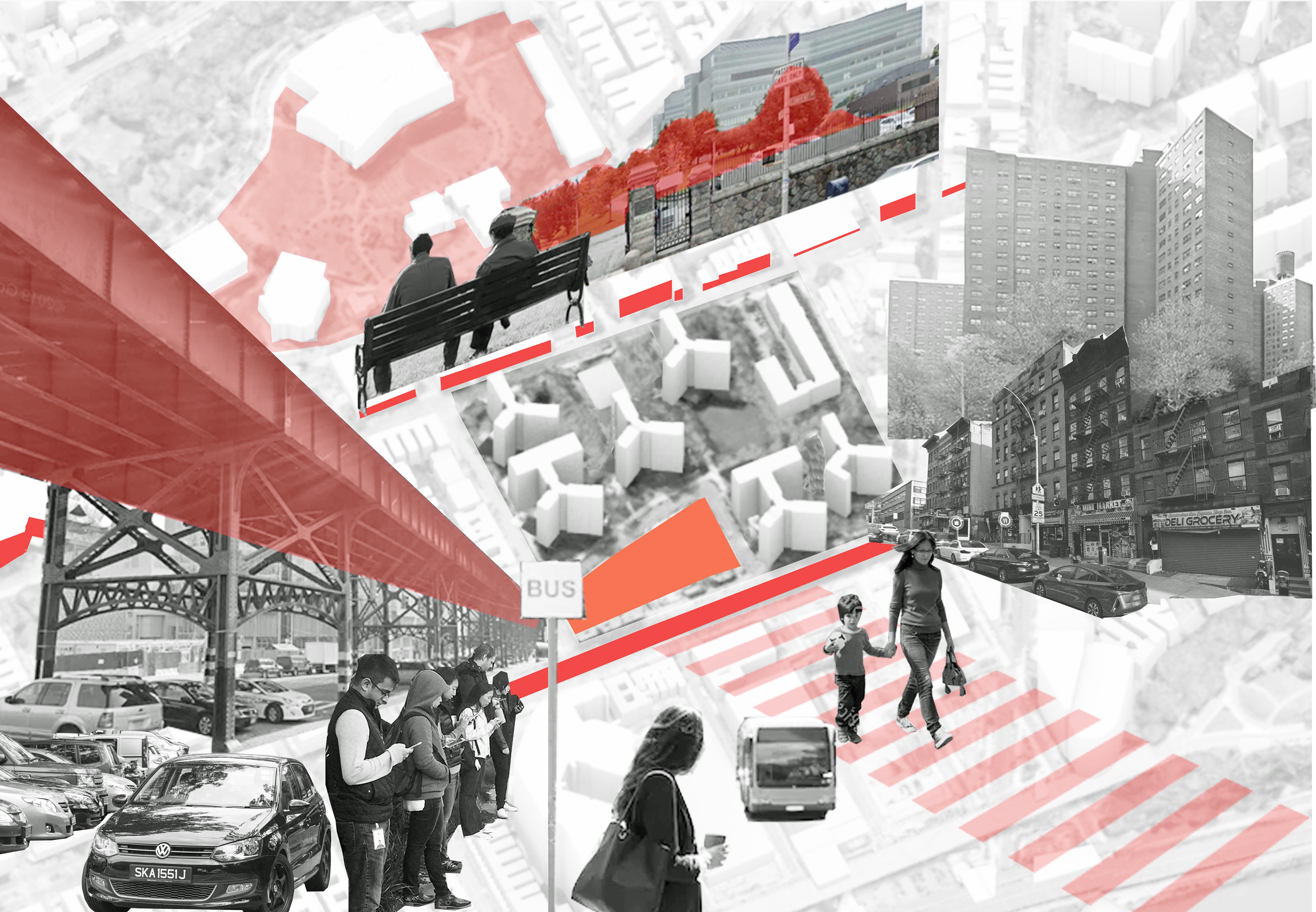
The site sits at the connecting point between Manhattanville houses and the Columbia expansion zone, as well as a connecting point to the historic IRT Broadway Line Viaduct and bus stops underneath it. At the elevated level, the site provides views that make potential connections to the Hudson River on its west, the Manhattan skyline and Manhattanville houses park on its southeast, to the beautiful neighborhood fabric on its north, and a glimpse of St. Nicolas park on its northeast corner. Despite it being at a crucial connection point, the boundaries set by fences and tall and/or bare solid facades in the neighborhood make a division that creates separation between each zone.
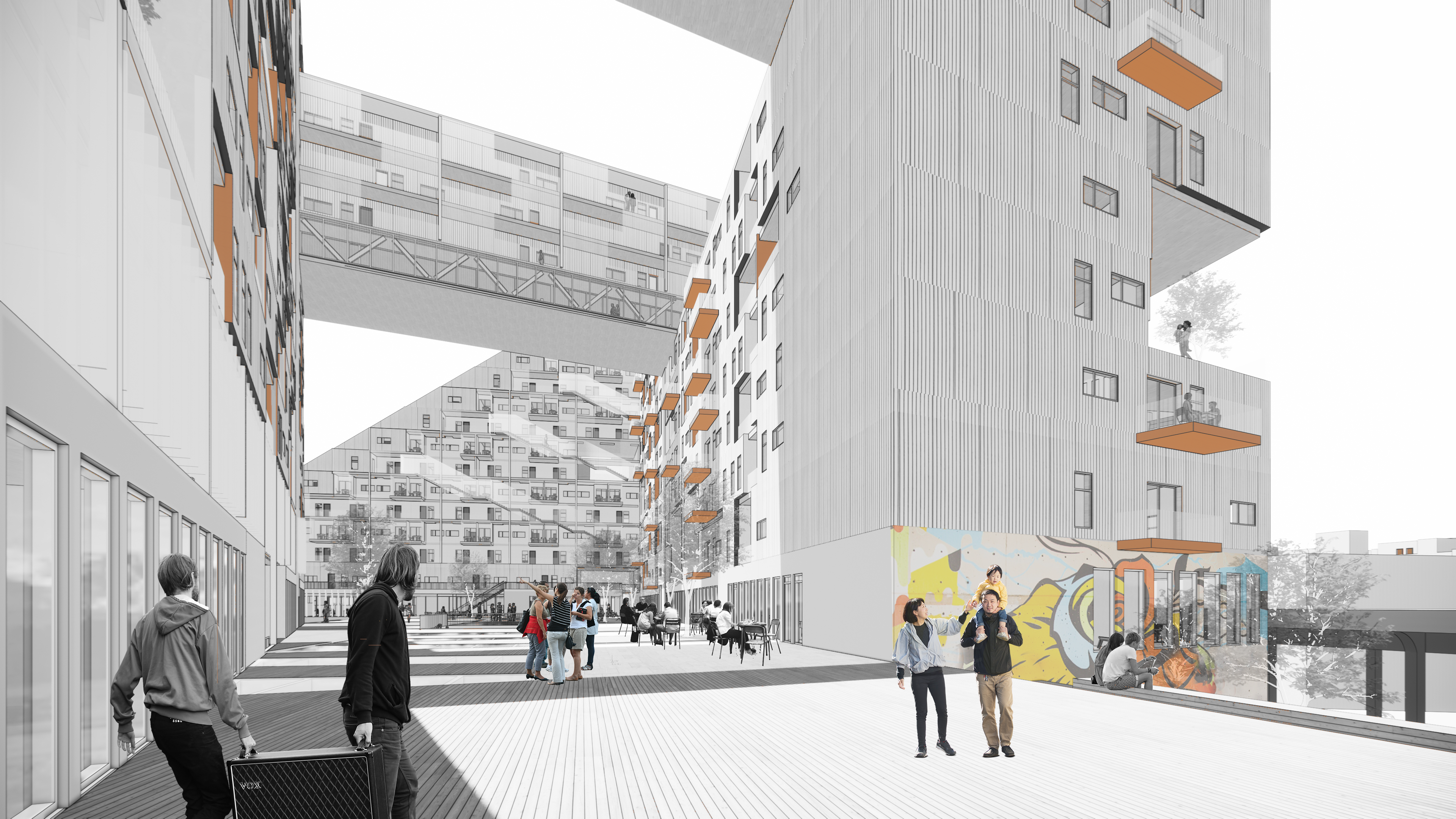
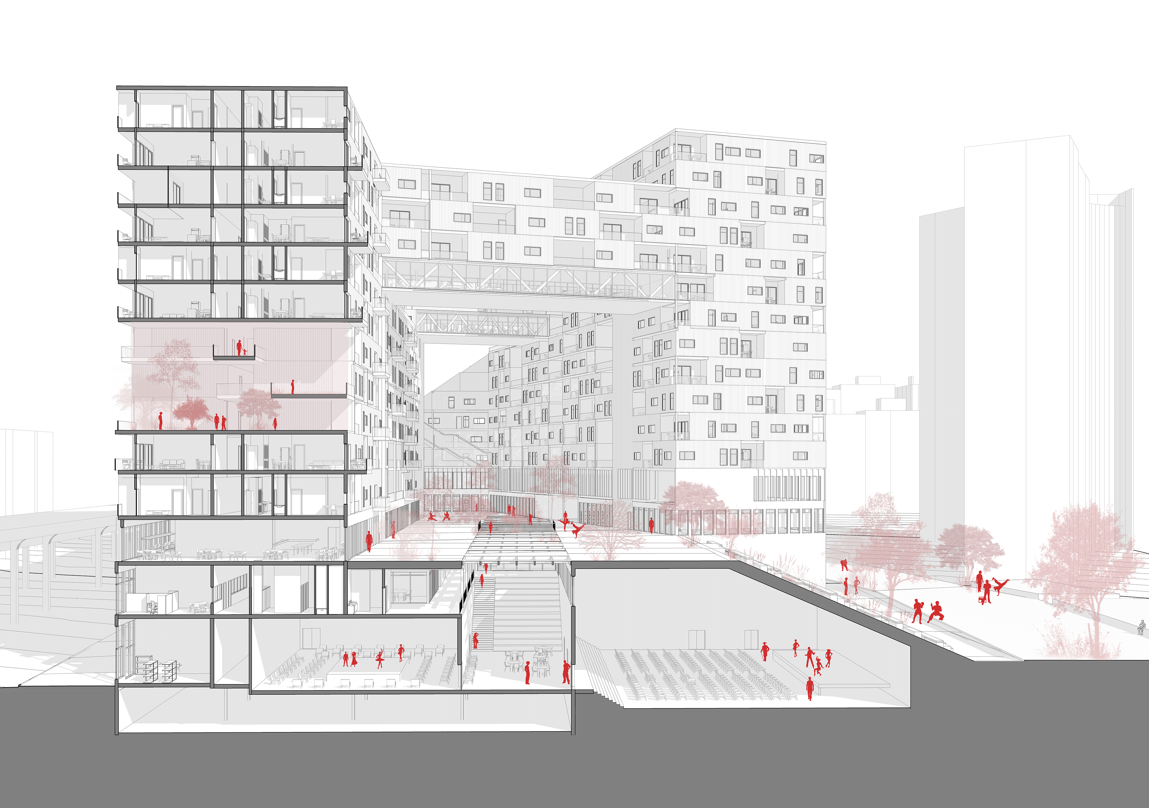
Our purpose in our investigation of our site is to identify the divisions and to find the connection which we could amplify to dilute and bridge the disconnections. In response to our findings, we took several different approaches to massing strategies to bridge the boundaries and make connections. We have decided to take the general form of the L-shape + grading that creates a connection to the park of Manhattanville Houses and to apply the porosity of the porous scheme to introduce physical passage and passage for views, lights, and air.
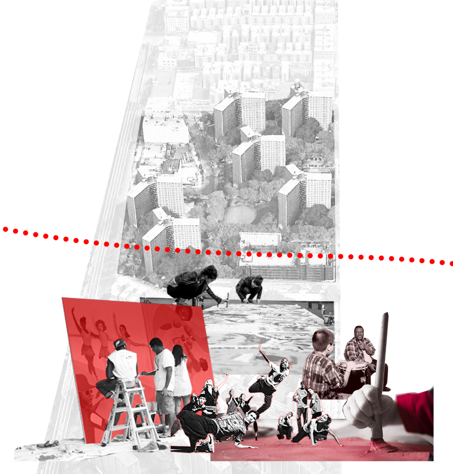
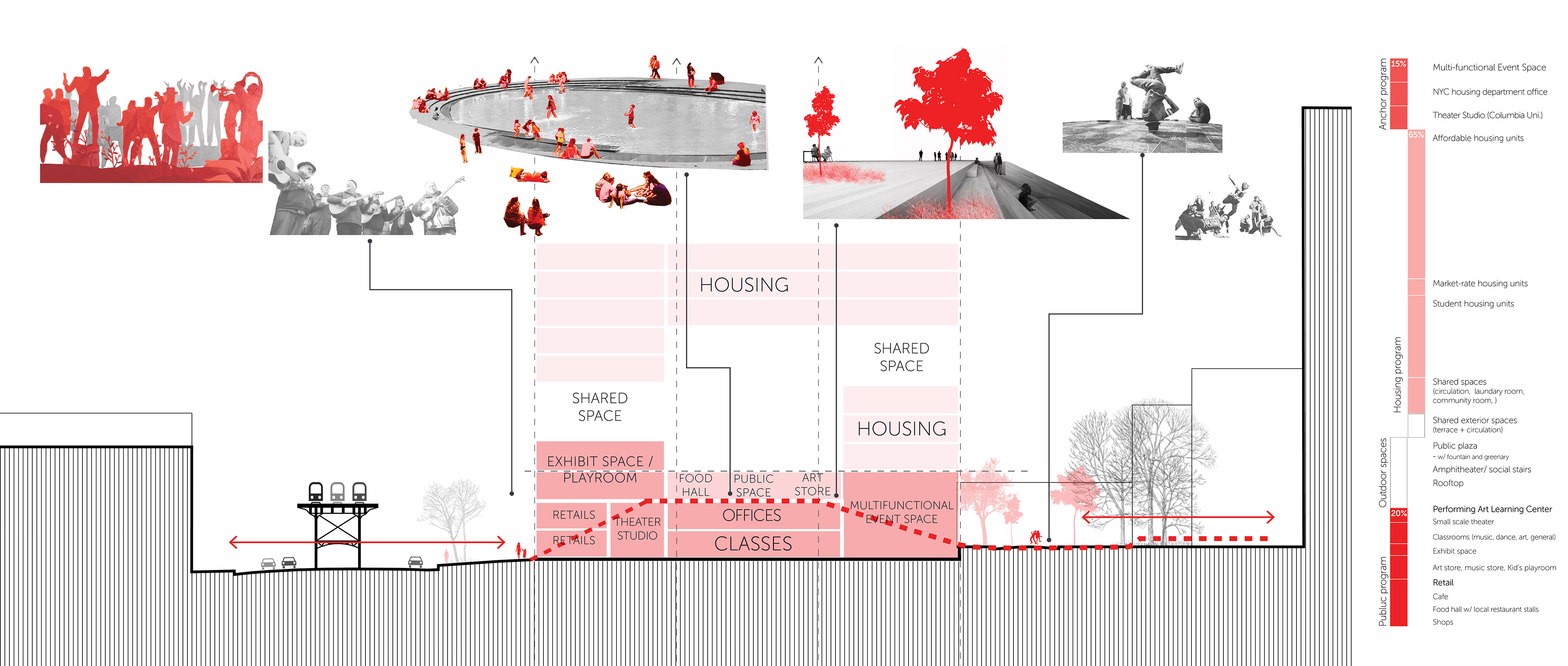
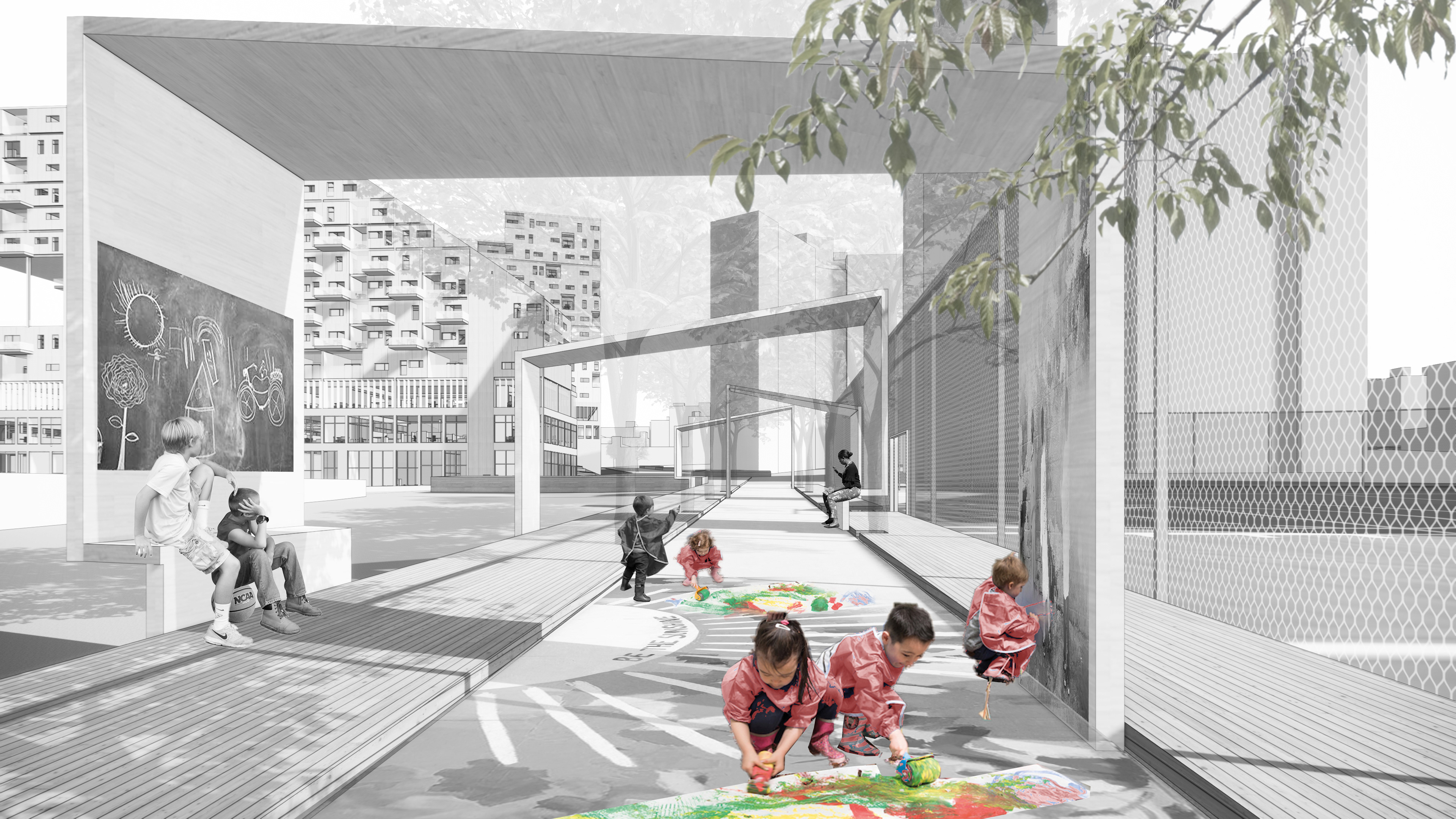
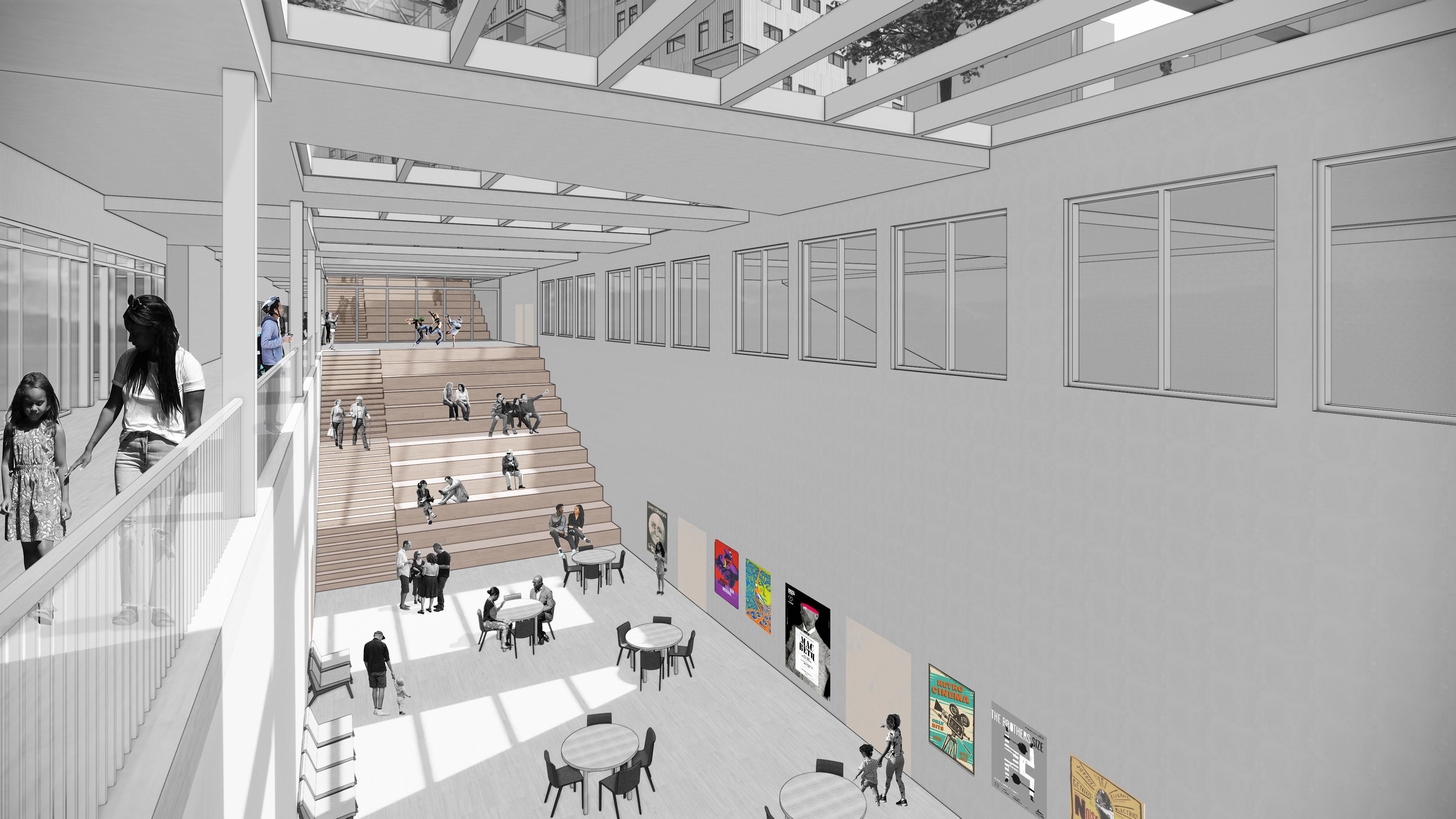
Also by recognizing the limitation of cultural programs provided by Columbia University to Manhattanville’s residents, we propose a community center for performing arts that celebrate arts and music of the people of Manhattanville by providing a friendly learning environment and formal and informal performing stages that encourage social and community events and engagement for the residents in Manhattanville.
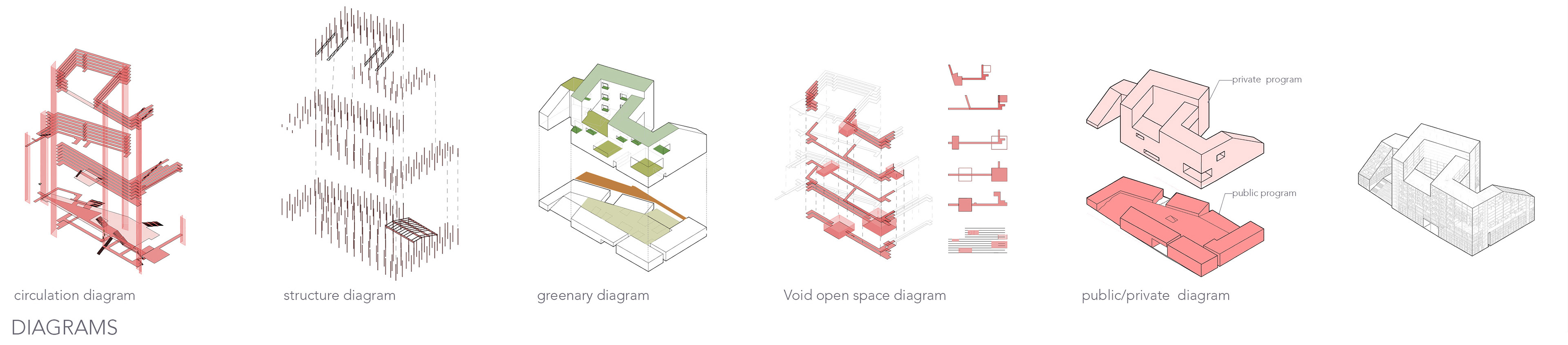
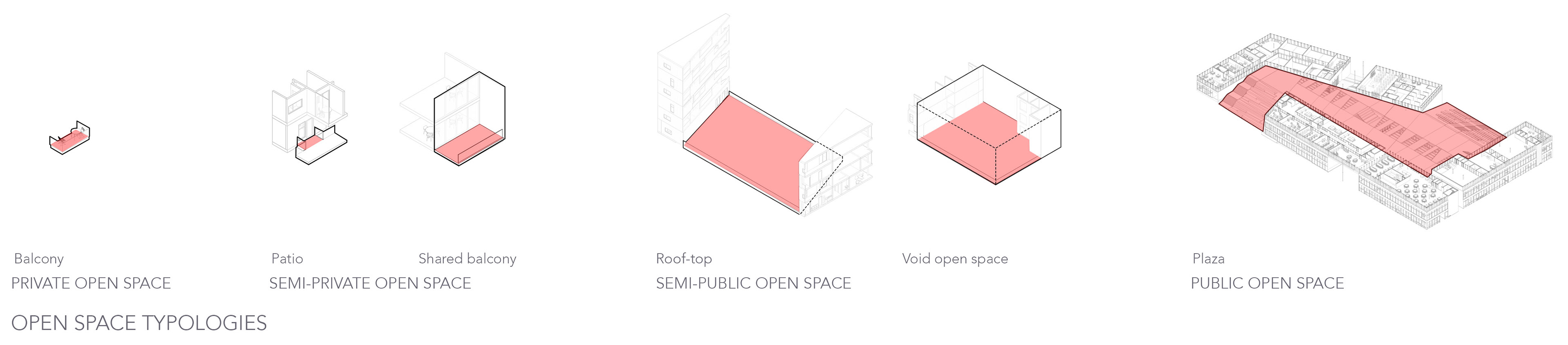
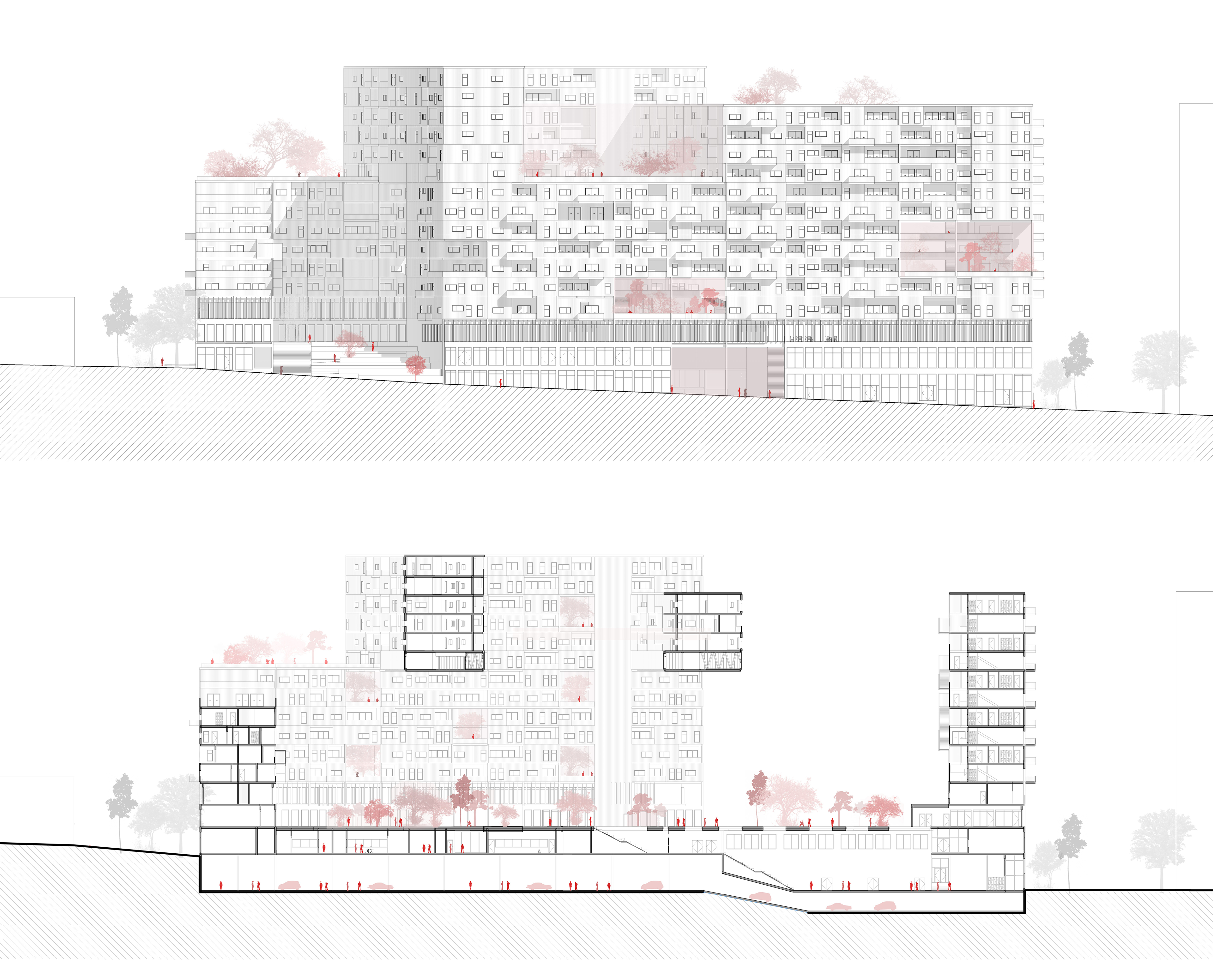
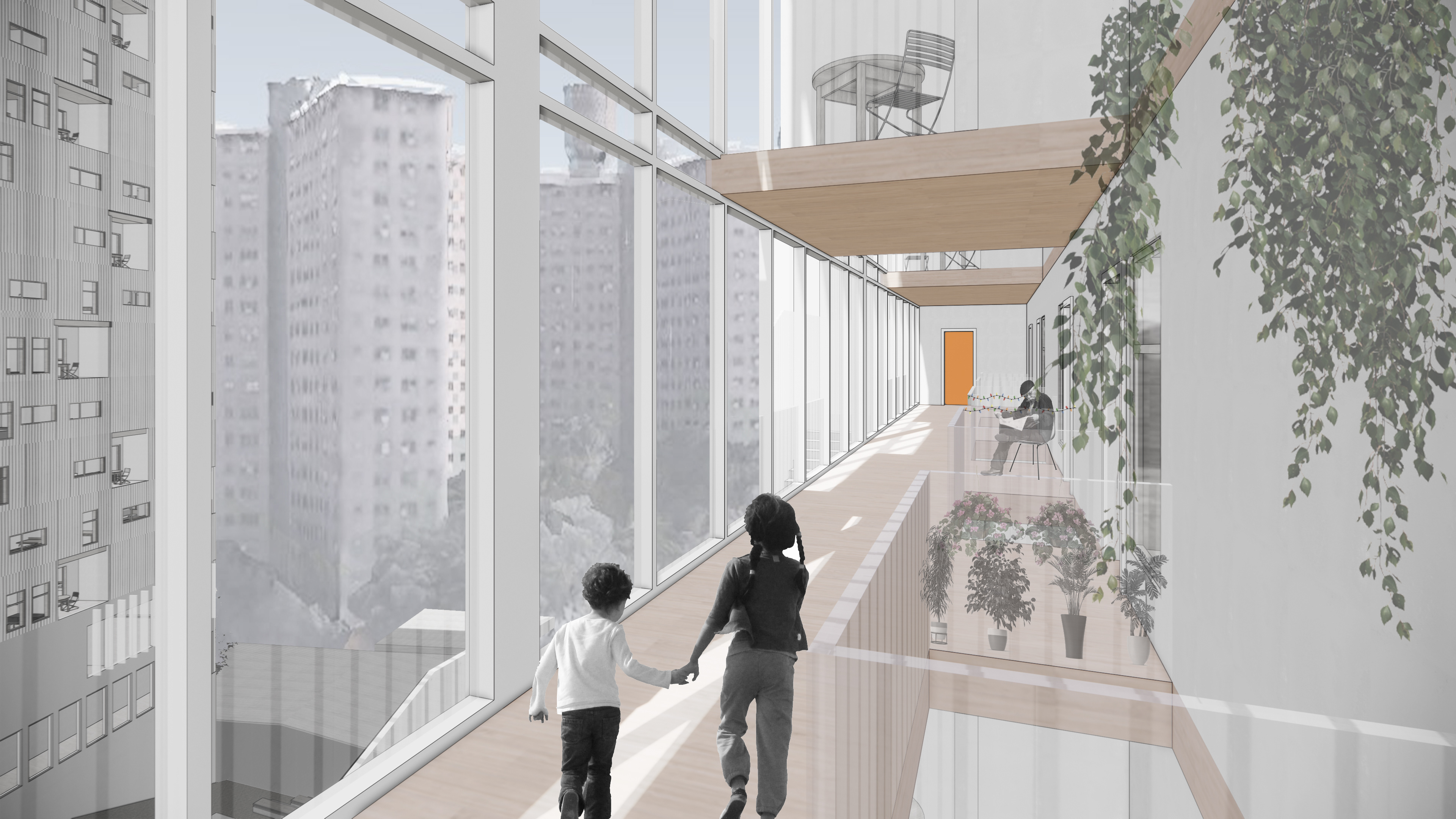
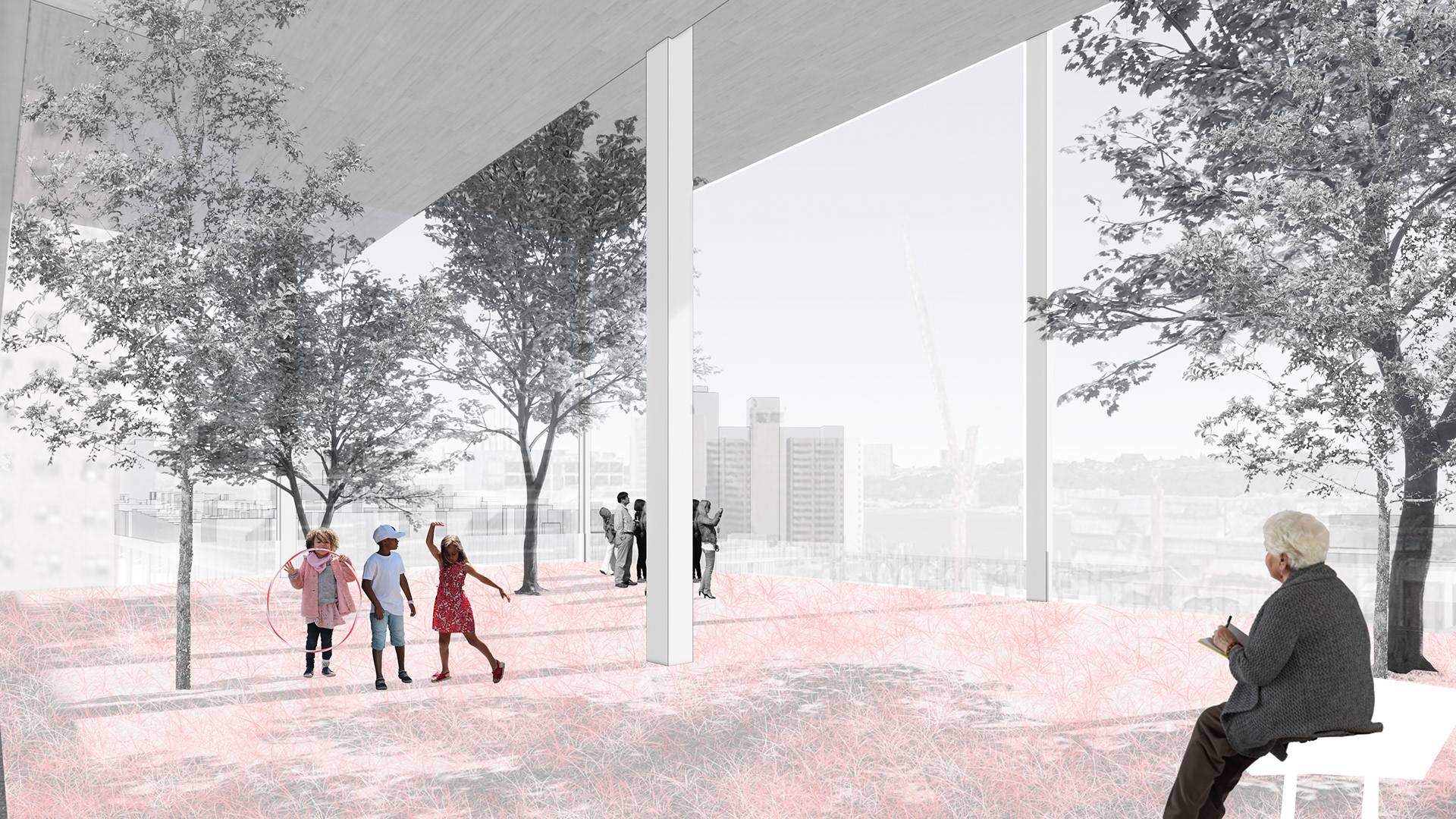
Our approach to designing for affordability extends beyond providing a public benefit program on the site. We designed to create a dense piece of the city offering many units while creating the quality of life through the circulation system and shared void spaces. While maintaining a high density of increased FAR, FAR 7.5, we tried to keep a void, open space on each floor that provides a social gathering space for the residents that can promote sub-community and block culture within the building. We have provided different scales of outdoor open space for all the residents spanning from private outdoor space through the provision of a balcony for every unit, to semi-private, semi-public outdoor spaces provided by various shared open spaces at the housing program, and finally to public open space at the ground level.
![Historic transformation site analysis conducted in collaboration with Rafi Alam [M.Arch 2022]..](https://cdn.myportfolio.com/1c51a354c4b3f76b2c588b7c4f0368d6/14d0db0e-deb1-41f3-8174-129f80a42b02_rw_3840.jpg?h=b168bed2fe1ad88be0e2f5eb8a86e056)
Historic transformation site analysis conducted in collaboration with Rafi Alam [M.Arch 2022]..
![Historic transformation site analysis conducted in collaboration with Rafi Alam [M.Arch 2022]..](https://cdn.myportfolio.com/1c51a354c4b3f76b2c588b7c4f0368d6/29ced4d5-234c-4d44-abf7-ca0bc9f1a677_rw_3840.jpg?h=dedb6b6fefe4310c14284c51d91511fe)
Historic transformation site analysis conducted in collaboration with Rafi Alam [M.Arch 2022]..

Historic transformation site analysis conducted in collaboration with Rafi Alam [M.Arch 2022].
This study of historic transformations showed how much erasure and transformation Manhattanville has experienced. New York built itself up from Lower Manhattan in the south toward Harlem in the north. This wave of growth meant a periodic erasure of what defined Manhattanville as a historic town. Industries changed practices, and community needs evolved, while demographics shifted drastically, resulting in constant replacements of the places which could have defined Manhattanville’s existence culturally and economically unique from its neighboring Harlem or Columbia University-dominated Morningside Heights. This replacement introduced multiple object-like buildings that alienated themselves from the existing urban fabric.
Our site is one of the locations that have experienced a lot of erasures and where multiple object-like towers were erected creating isolation and boundaries in the neighborhood. As we approached the issue with the critiques of erasure we do not want to neglect the towers by proposing to remove or to erase but rather to treat them as historical artifacts, by looking for strategies to bridge the boundaries that it creates.
-This study was conducted in collaboration with Rafi Alam [M.Arch 2021].
Identifying boundaries | Collage
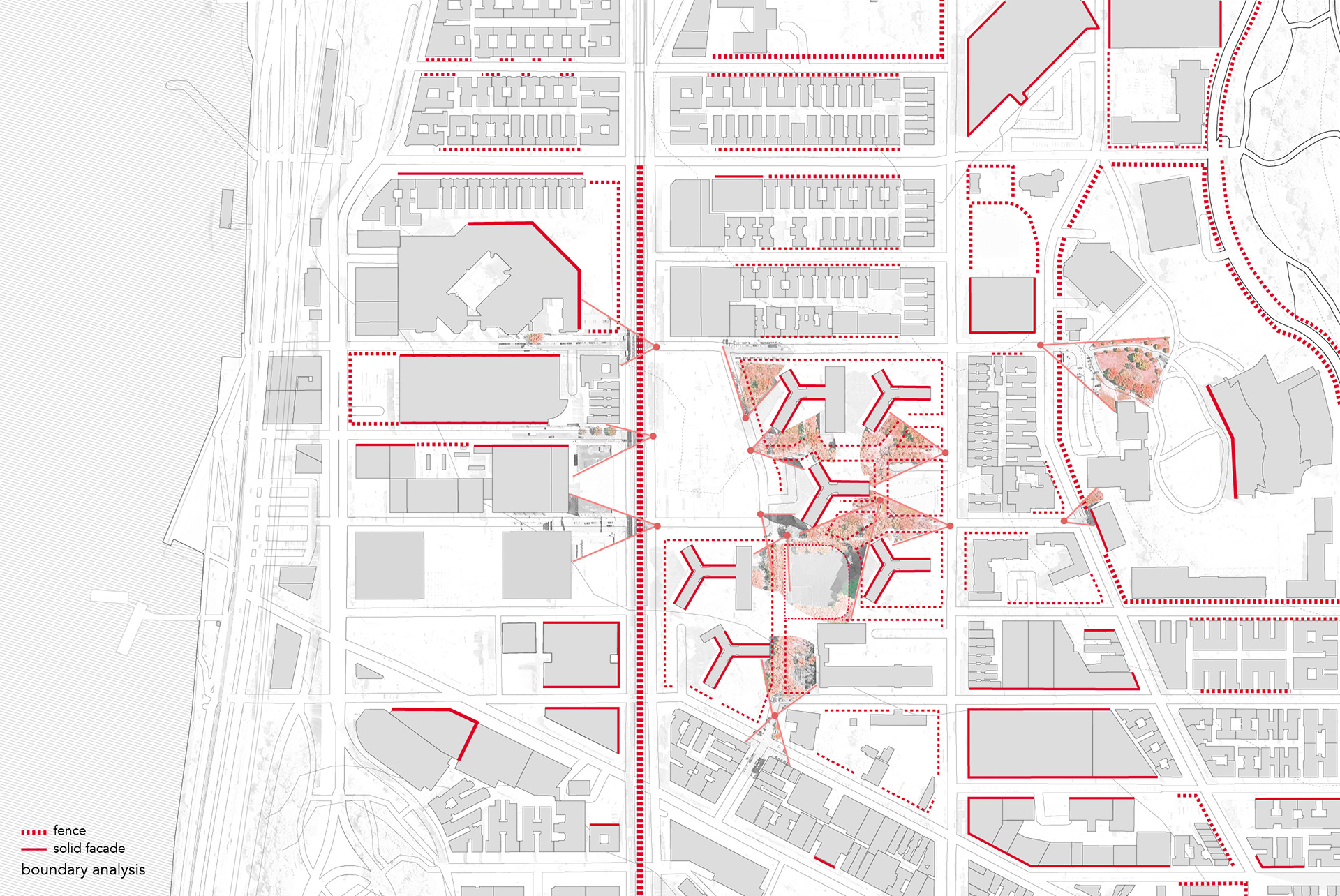
Identifying boundaries | Boundary Analysis
Identifying boundaries - As we studied the site we notices multiple boundaries surrounding the site. On the east side of the site, there are two macro open spaces, Tower housing and the city university of New York Research Center. Both of the spaces are fenced off and are made mainly accessible for specific people and they become a huge boundary for the public. On the west side of the site at Broadway, there is a Subway viaduct in the middle of the road which currently serves as a parking lot under the viaduct. For the pedestrians, this place they cross and wait for buses is dominated by vehicles which sets up a huge linear boundary that acts as a large scale fence.

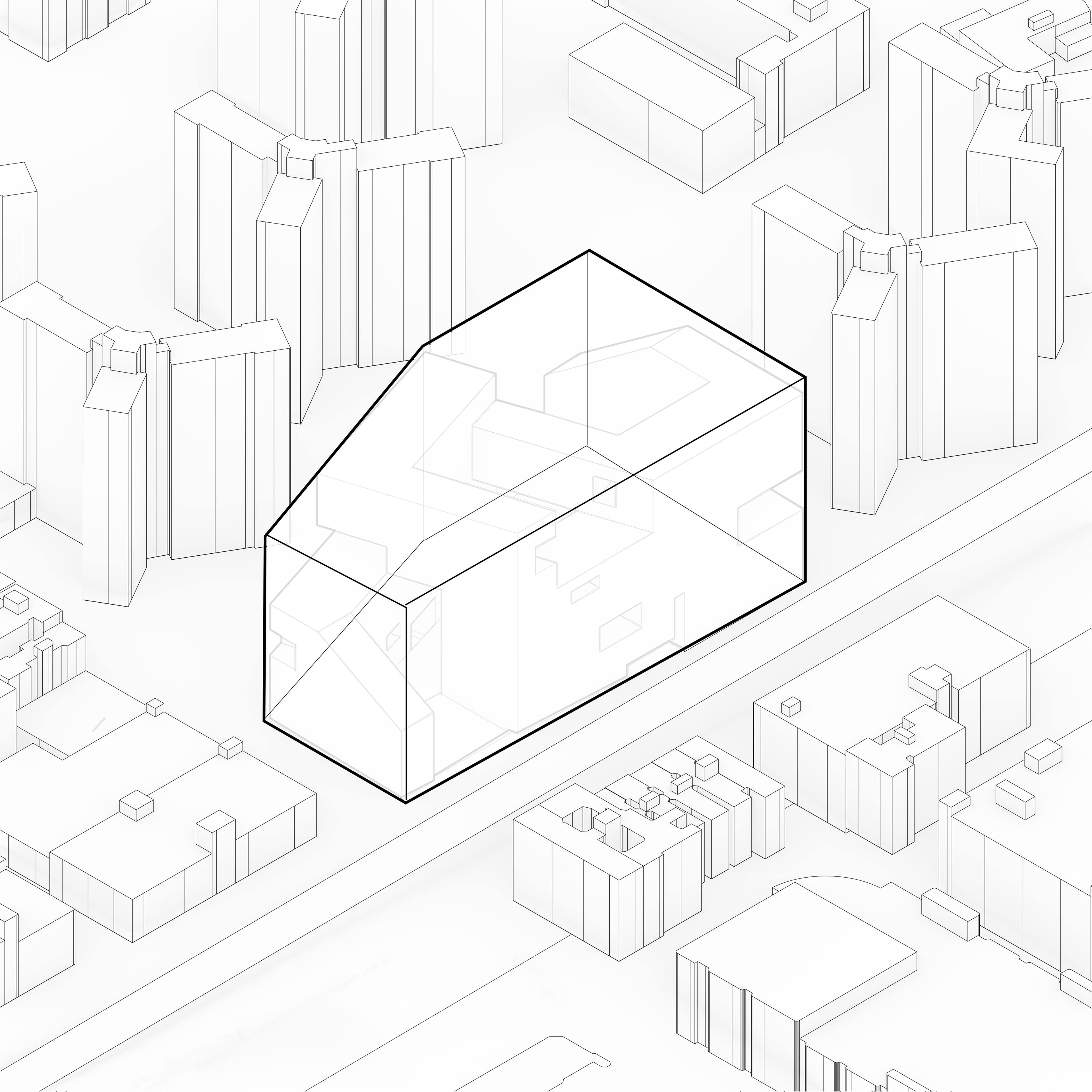
Object
Contextualized Object

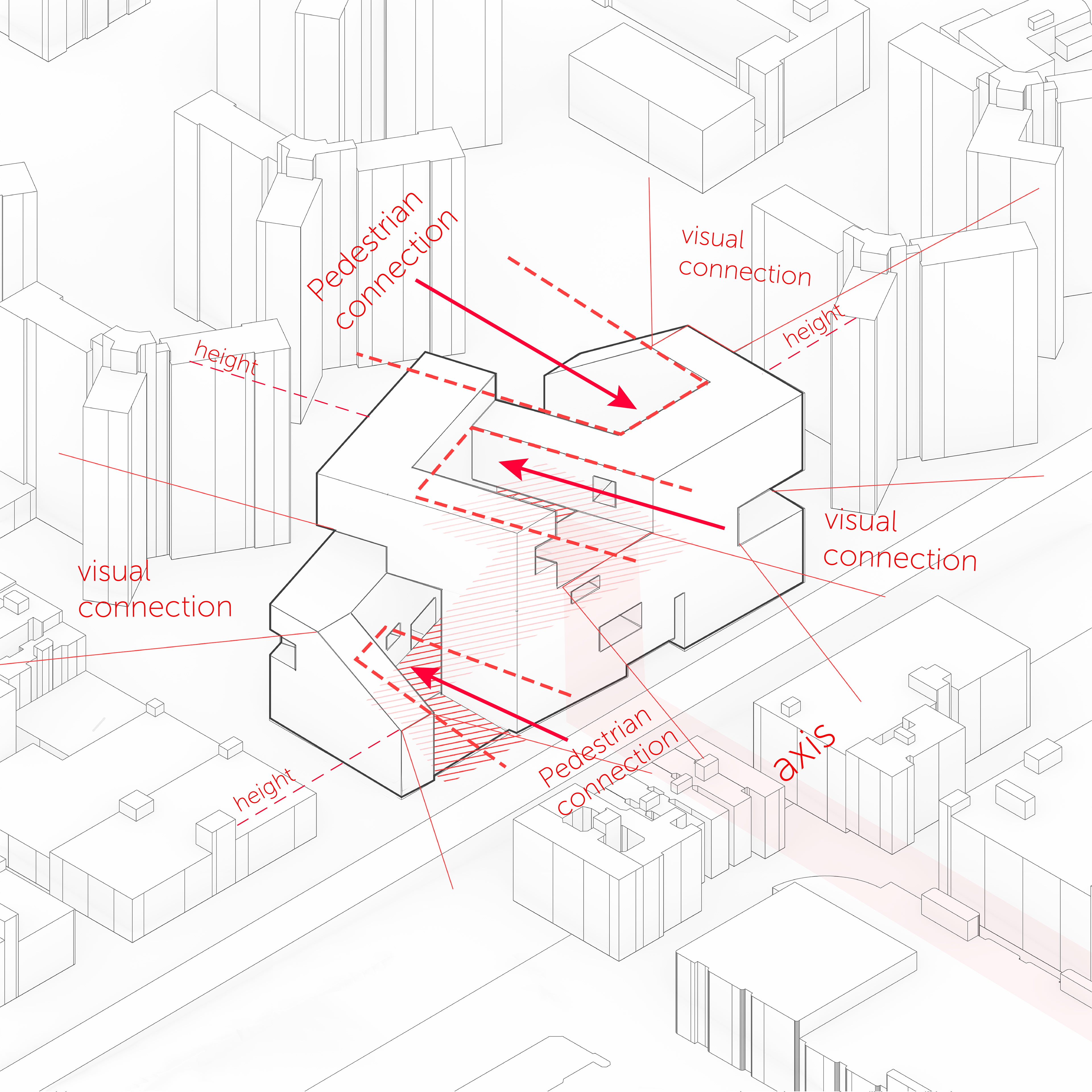
Pedestrian movement through
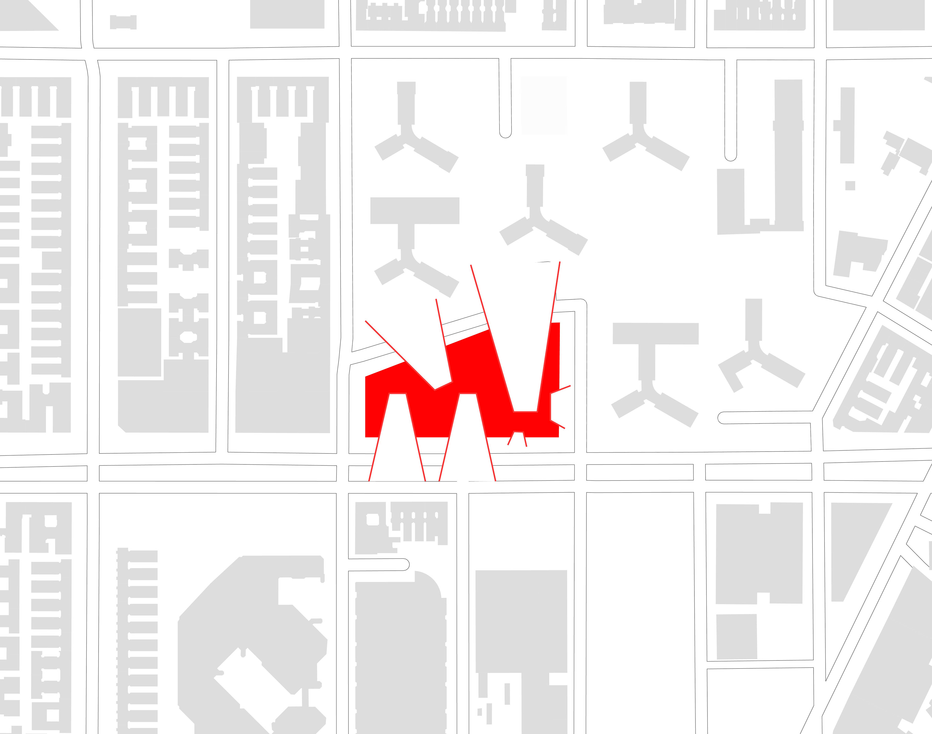
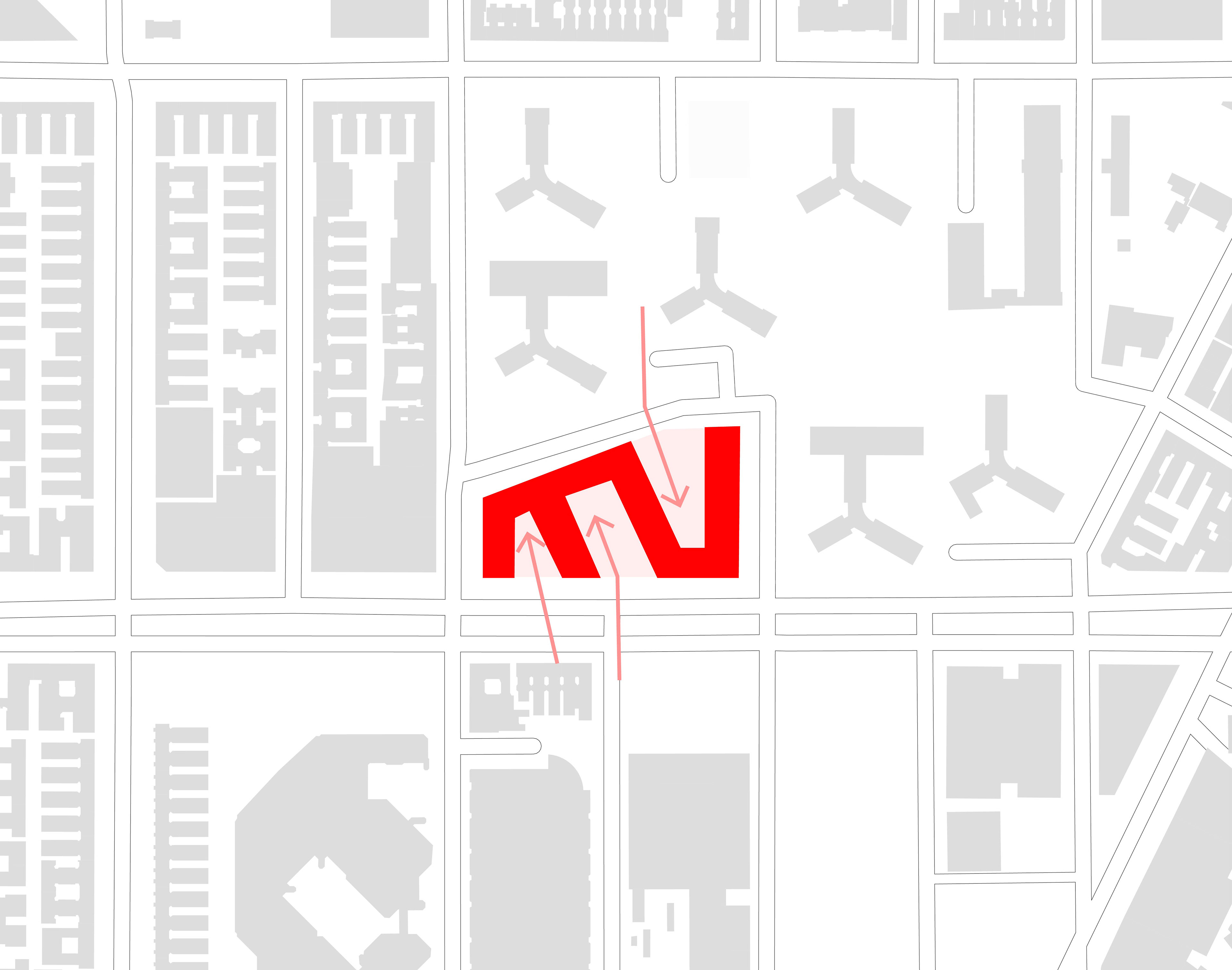

The site is located at the intersection where the urban fabric meets the alienated objects of buildings. We aimed to bridge division created by the two types by proposing a contextualized object that builds relationship with its surrounding context. The mid heights created by the slope or the open spaces would consider the height of the block on the north side and the taller height would make relationship with the height of the residential towers on its south and east side. The different openings of the massing also provides pedestrian connection at the ground level and visual connections at the upper level (visual connection that responds to the different views studies).